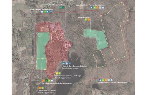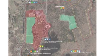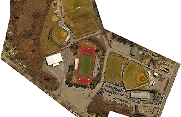
The City of Lowell requested a feasibility study of a site for a new high school. The six-acre site was being used as an athletic facility which included a football stadium, parking lots, baseball field, and practice fields. The final site for the new high school building had not yet been determined, so gathering this existing data was of high importance to the client.
Nitsch provided land surveying services for a boundary, topographic, utilities, and wetlands survey of the site. Additionally, they were hoping to get the data quickly and for less cost than traditional surveying methods. By conducting a UAV (drone) flight to capture the existing conditions, we were able to meet the City’s time and cost requirements.
Key Collaborators
Owner: City of Lowell
Architect: Perkins Eastman