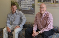
Nitsch Engineering is pleased to announce that Jamie Gayton, PLS, and Mark Siegrist, PLS, have joined Nitsch Engineering’s Land Surveying Department as Project Managers. With almost 50 years of combined experience in land surveying, Jamie and Mark expand Nitsch Engineering’s knowledge and expertise to meet the needs of the firm’s land surveying clients.
Jamie Gayton, PLS, has more than 18 years of experience in the field of land surveying. During his career, Jamie has worked with public agencies, property owners, architects, engineers, developers, and contractors to provide land surveying services on a wide range of projects. His experience includes managing surveying and mapping projects, performing network adjustments for conventional and GPS networks, calculating property line and right-of-way lines, preparing topographic and existing condition surveys, preparing ALTA/ACSM Land Title Surveys, preparing existing conditions and as-built plans, preparing Activity and Use Limitation (AUL) plans, and overseeing laser scanning projects. Jamie is experienced in using Carlson Survey, AutoCAD Civil 3D, GPS, laser scanners, and robotic total stations. He is dedicated to using his computer skills and the latest technologies to determine the most efficient procedures for accomplishing a project’s goals. Jamie is a registered Professional Land Surveyor in Massachusetts, and completed coursework in survey and structural technology at the New Brunswick Community College in Canada.
Mark Siegrist, PLS, has over 30 years of varied land surveying experience for a wide range of various public and private sector projects. He specializes in providing boundary retracement surveys, supporting construction layout of projects, supporting all phases of subdivision design and approval, performing right-of-way surveys, performing GPS surveys, preparing ALTA/ACSM Land Title Surveys, performing Land Court surveys, preparing as-built and easement plans, performing AUL surveys, preparing lease plans, performing topographic and existing conditions surveys, establishing photogrammetric control surveys, assisting with FEMA flood elevation certifications, and preparing condominium plans. Mark is an experienced user of GIS, AutoCAD, Microsoft Office, Carlson Survey, Carlson Civil Suite, and Robotic Surveying technologies. He is also an active member of the Massachusetts Association of Land Surveyors and Civil Engineers (MALSCE) and has served on their board of directors. Mark is a registered Professional Land Surveyor in Massachusetts, and earned his B.S. in Civil Engineering from Wentworth Institute of Technology.