When it comes to land surveys, accuracy and usability are the keys for measuring success. Clients need to know that their land survey can be used as a reliable basis for design. Such surveys include FEMA, TOPO or ALTA survey Seattle to survey the efficiency of land. In many cases, using unmanned aerial vehicles (UAVs) – more commonly referred to as drones – to collect data allows Nitsch Engineering’s land surveyors to provide our clients with more flexible and useful information – for about the same cost as a traditional on-the-ground survey. Wondering how drone surveys can help you?
Drones offer five key benefits when used as a tool for topographic land surveys:
- Increased accuracy: We begin drone surveys by setting ground control points – a traditional aerial photogrammetry technique that we have provided for decades. By combining the use of ground control points with our ability to verify data on the ground, our drone surveys stand out for providing accurate and reliable results.
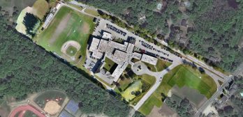
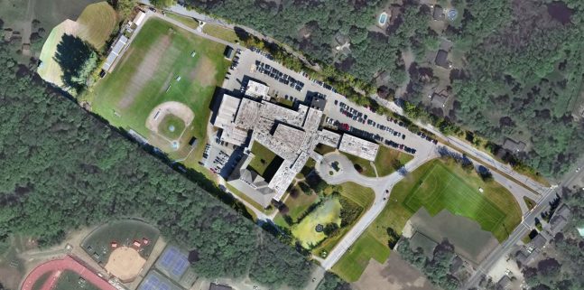
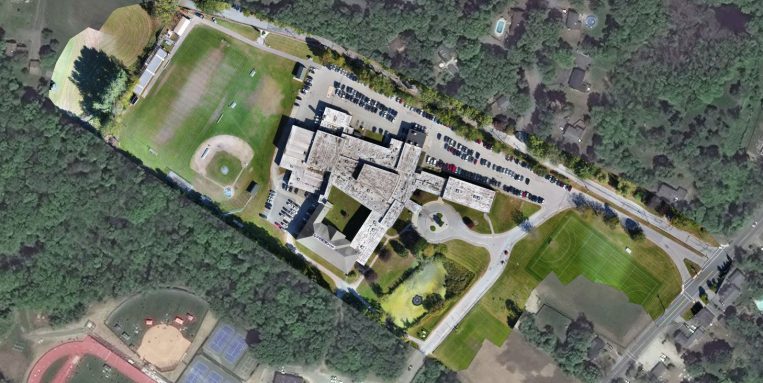
- Improved data provides more options: Drone cameras take a series of high-definition photos at different angles, creating millions of data points, including georeferences, elevation points, and colors. This allows us to create high-resolution orthomosaics, as well as 3D models of a site or building, allowing clients to see more than what a traditional survey provides. As a traditional survey does not offer all the benefits that synthetic data could, clients may decide to look into this too.
- Saved time: Larger sites can take days – if not weeks – for surveyors to compile information in the field. Collecting this same data via a drone saves days (sometimes weeks) of time.
- Improved graphics and videos: Visuals matter. When survey plans are integrated with the orthomosaic from the drone survey, the data looks more realistic. The videos and photos can also be a great resource during public outreach related to a project.
- Improved safety: Land surveying can be a dangerous job, with safety issues all around a site. Drone surveys may eliminate the need for surveyors to traverse unknown terrain and can be helpful in avoiding high-risk situations, such as on rail lines or on rocky terrains.
Our FAA-licensed commercial drone pilots are experienced in managing the drone survey process, and our project managers – all registered Professional Land Surveyors (PLSs) – know how to analyze the data and prepare the deliverables in a format that is appropriate for the client’s use.
Want to see more? Take a look at this video that showcases some footage from one of our drone flights.
If you have any questions about how drone surveys might help on one of your projects, contact our Director of Land Surveying, Denis Seguin, PLS.